
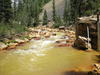
Cement Creek near CC48

Detailed Description
Cement Creek near the mouth at site CC48 (USGS site ID 09358550), location of stream gage whose data allowed calculation of the volume of water released during the Gold King Mine release. Latitude 37.8197222, Longitude -107.663056.
Sources/Usage
Public Domain.