
Citizen Science Buffelgrass Observation

Detailed Description
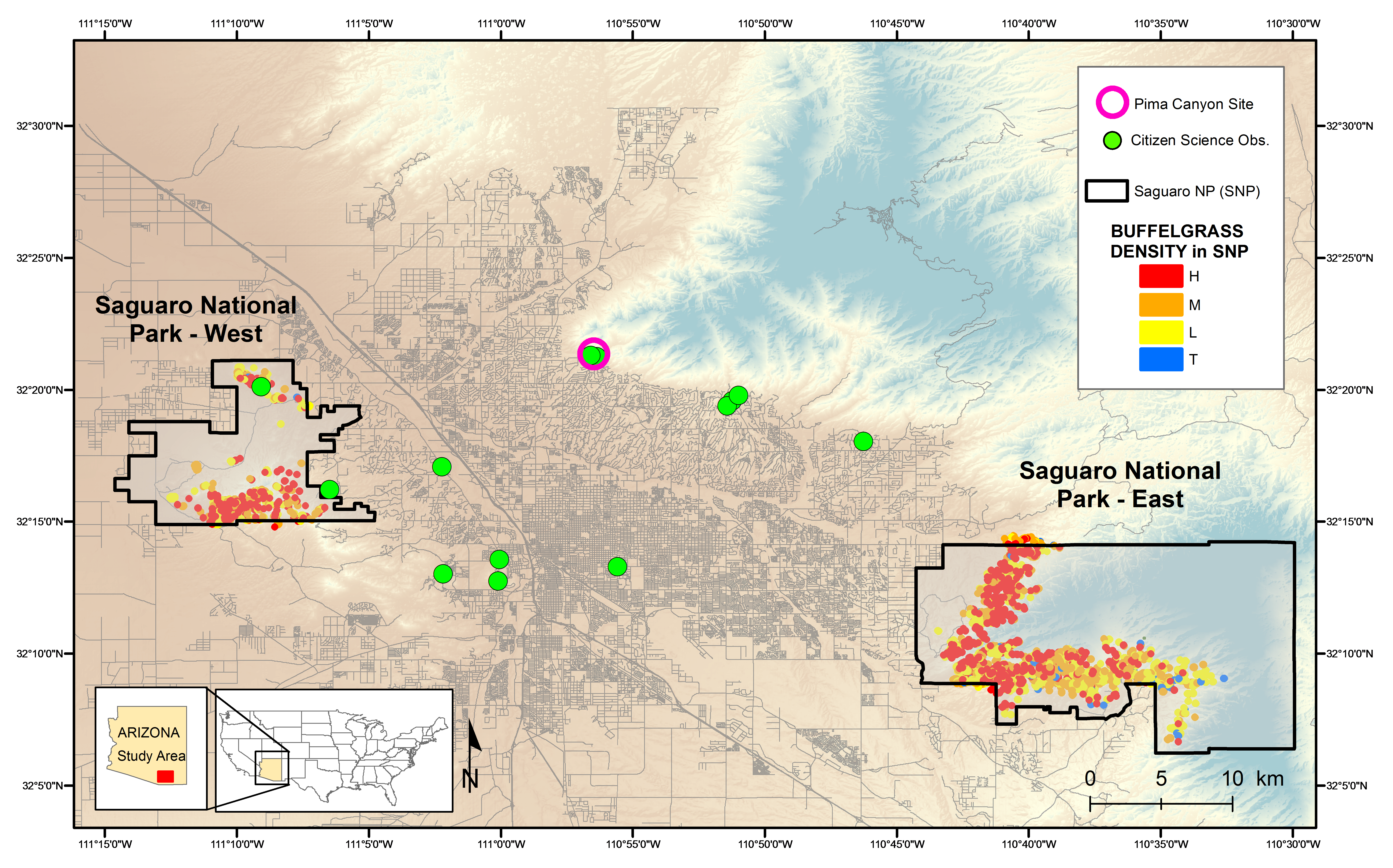
Figure 2.Map showing the locations of the citizen science buffelgrass observation sites in Tucson, Arizona, and the outlined polygons of buffelgrass patches in Saguaro National Park East and West. Buffelgrass density is coded as High (H); Medium (M); Low (L) and Trace (T).
Sources/Usage
Public Domain.