
Coast of New Jersey
By Woods Hole Coastal and Marine Science Center
2013 (approx.)
Detailed Description
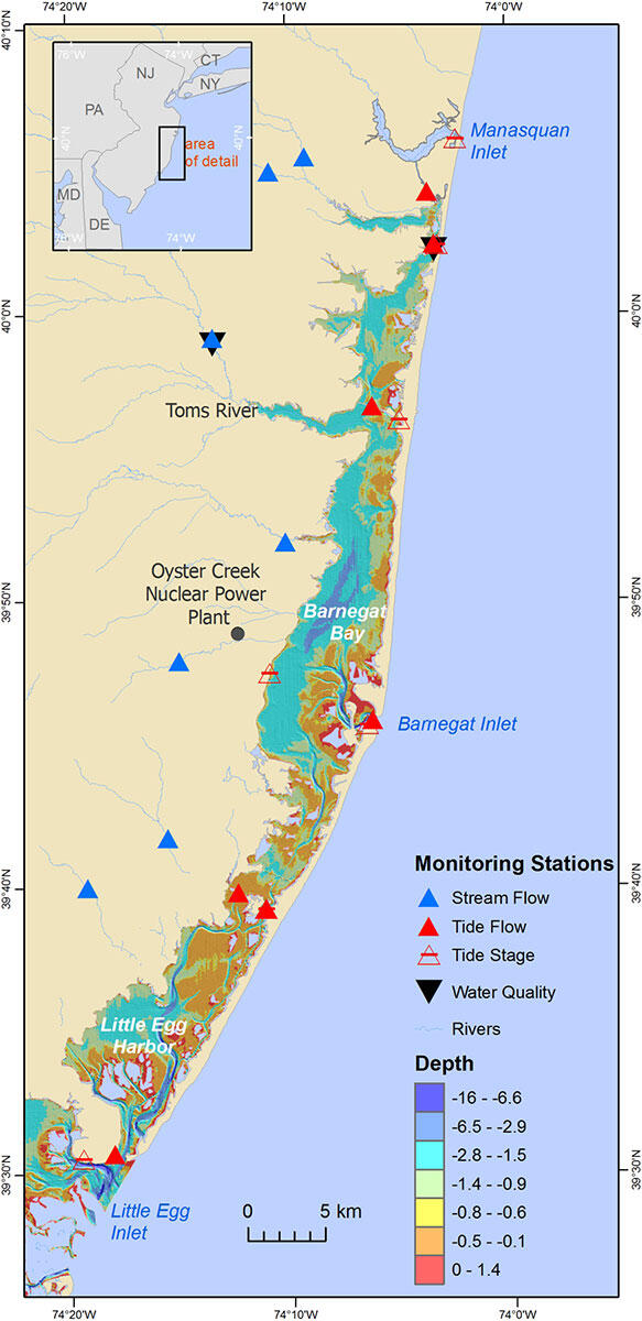
Coast of New Jersey, showing Barnegat Bay-Little Egg Harbor estuary and its three inlets—(from north to south) Manasquan, Barnegat, and Little Egg—and locations of USGS hydrologic monitoring stations. Color-coded depths in estuary are gridded data from the National Oceanic and Atmospheric Administration (NOAA) Estuarine Data Set. Acquired in the 1930s, these are the latest comprehensive bathymetric data collected in the estuary before the current survey.
Sources/Usage
Public Domain.