
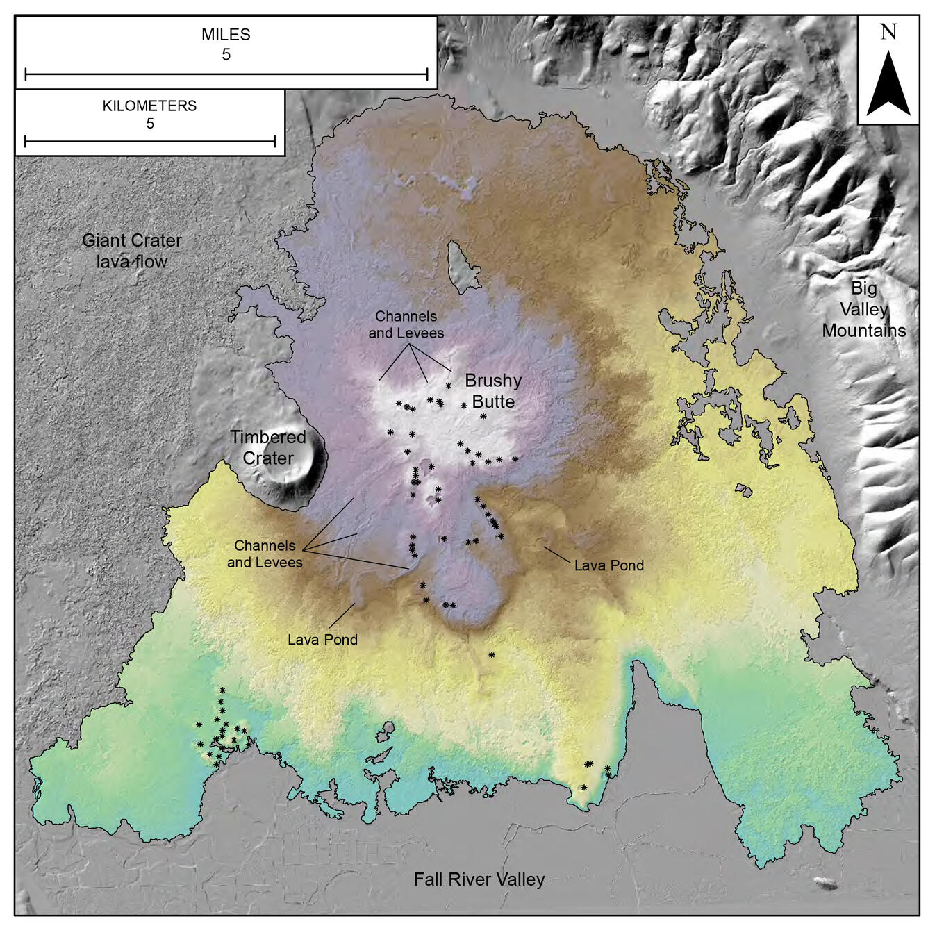
Colored, shaded-relief terrain map of Brushy Butte Volcano
By Hawaiian Volcano Observatory
2020 (approx.)
Detailed Description
Colored, shaded-relief terrain map of approximately 490 feet (150 meter) tall Brushy Butte Volcano made using 1 yard (1 meter)-resolution LiDAR data and showing the vents as black dots with channels and levees winding across the landscape.
Sources/Usage
Public Domain.