
Comparison Landsat Surface Temperature and Dynamic Surface Water Extent

Detailed Description
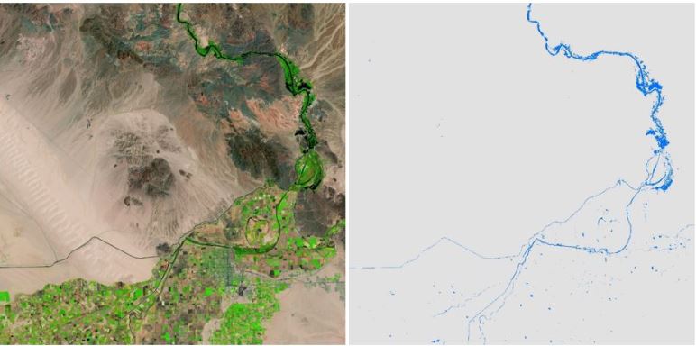
Side-by-side images over Northeast of Yuma, AZ of Landsat Surface Reflectance (SR) Analysis
Ready Data (ARD) tile (Left Image) and Landsat Level-3 Dynamic Surface Water Extent (DSWE) tile-based image
(Right Image) derived from Landsat 7 ARD Tile Horizontal 005, Vertical 013, August 16, 2000.
(Public domain)
Sources/Usage
Public Domain.