
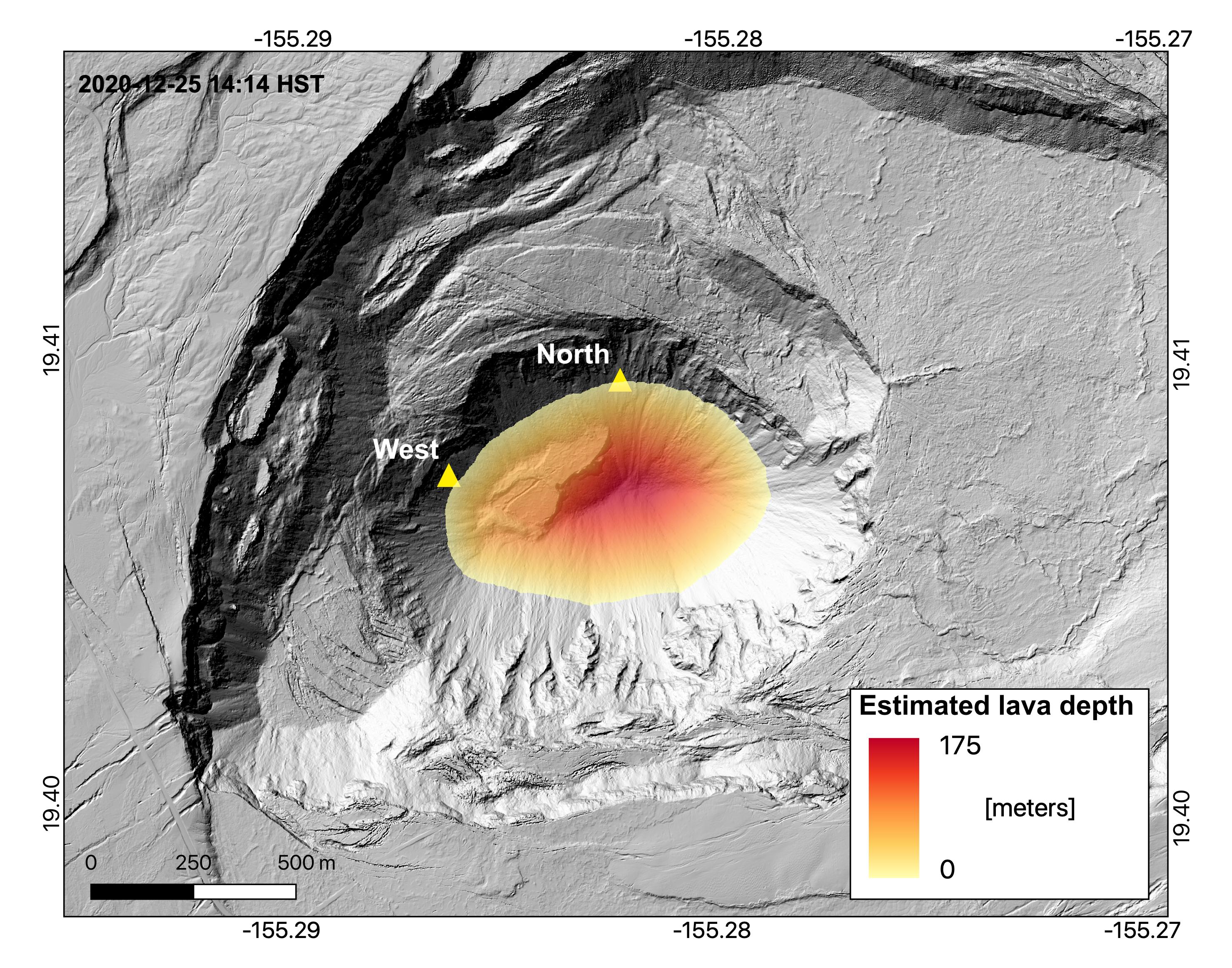
December 25, 2020, preliminary map of the lava lake depth at 2:15 p.m.
By Kīlauea

Detailed Description
Lava lake level measurements collected during a field visit of Kīlauea Volcano's summit around 2:15 p.m. HST on December 25, 2020, were used to create a preliminary lava lake depth map. When compared to pre-eruption topographic models, it shows that the bottom of Halema'uma'u crater has been filled by almost 176 m (578 ft) of lava. Map by H. Dietterich.
Sources/Usage
Public Domain.