
DEEP SEARCH 2017
By Wetland and Aquatic Research Center
2017 (approx.)

Detailed Description
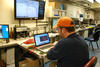
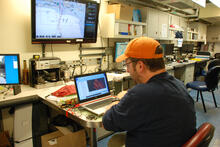
USGS geologist Jason Chaytor processes sidescan data from a recent AUV Sentry dive.These data will help us to better understand the seafloor environment and plan for future DEEP SEARCH expeditions.
Sources/Usage
Image courtesy of DEEP SEARCH 2017, NOAA-OER/BOEM/USGS