
Dorian NOAA imagery pairs: Location 3
By St. Petersburg Coastal and Marine Science Center
2019 (approx.)

Detailed Description
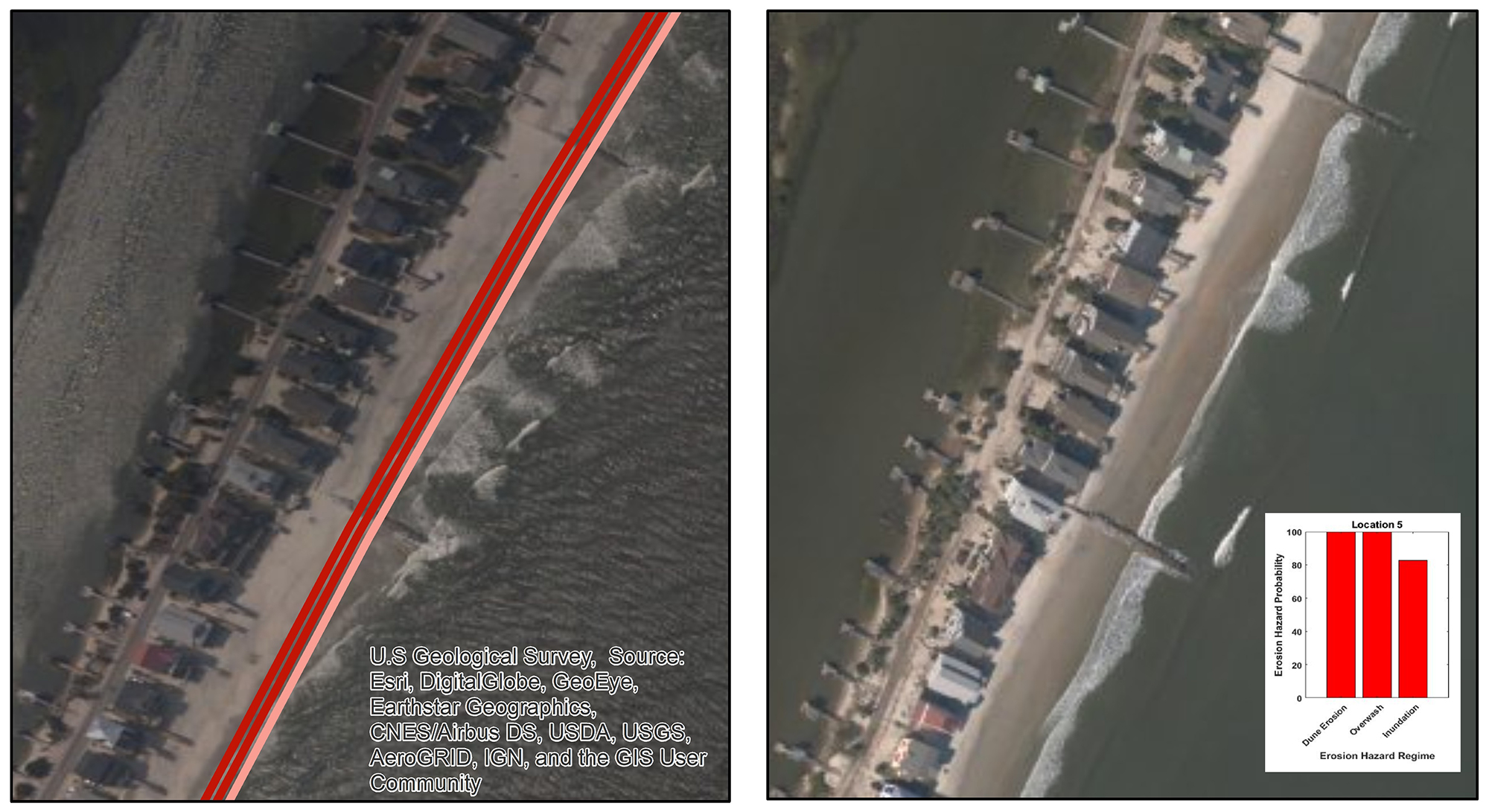
On the southern end of Pawley’s Island, elevated water levels overtopped the low-elevation dunes, transporting sand landward and over the road. The predicted probability of overwash was 100% for this location.
Sources/Usage
Public Domain.