
Drone collage
Detailed Description
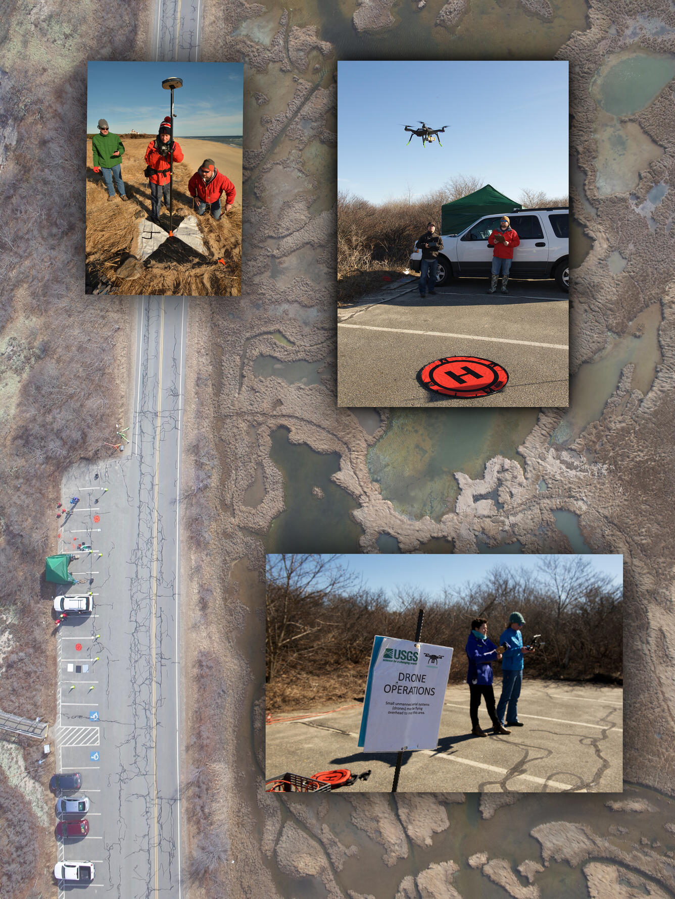
Top left- Rob Thieler, Sandy Brosnahan and Alex Nichols deploying ground control targets for a UAS study on Coast Guard National Seashore in Eastham, MA.
Top right- Seth Ackerman (pilot) and Alex Nichols (data recorder) conducting a mapping survey at Parker River National Wildlife Refuge, Newbury Ma. Photogrammetric techniques are used to stich together the photos collected from a drone, creating point clouds, orthomosaics and digital elevation models. These products will contribute to creating sediment budgets and marsh stability estimates.
Bottom- Emily Sturdivant and Elizabeth Pendleton conducting a mapping survey at the Parker River National Wildlife Refuge, Newbury MA, flying a 3DR solo drone.
Sources/Usage
Public Domain.