
Extent of Newberry lavas including approximate ages of surficial flows

Detailed Description
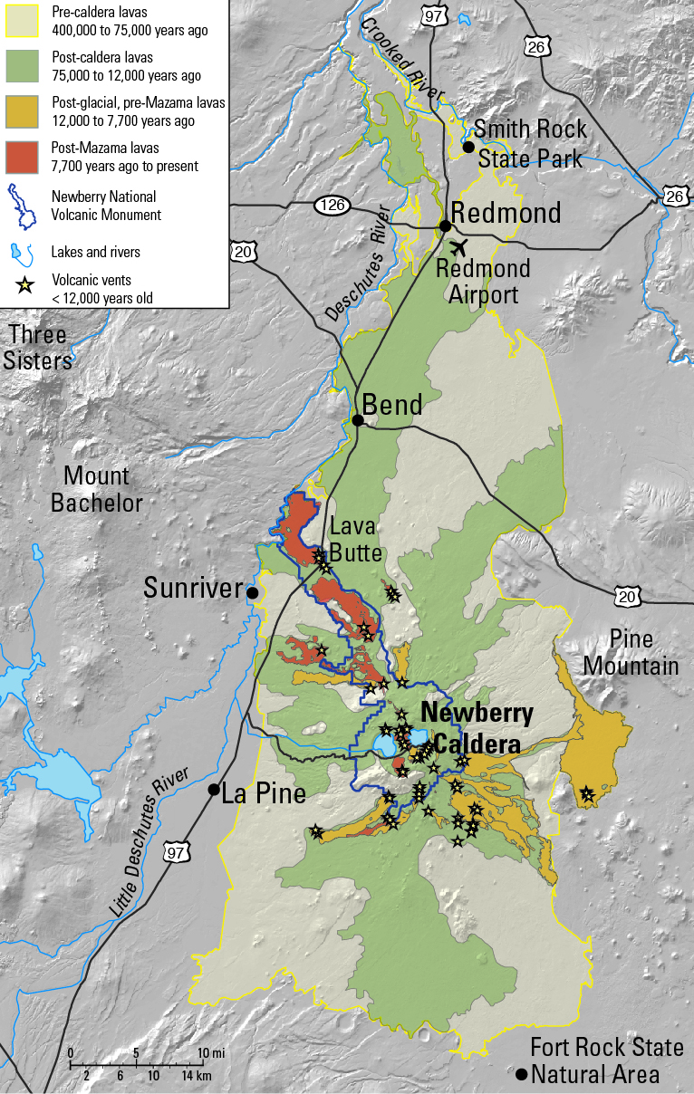
Extending approximately 75 miles north to south and 27 miles east to west, Newberry Volcano and its broad apron of lavas (light yellow shaded area) cover a total area of almost 1,200 square miles, making it the largest volcano of the Cascades volcanic chain. Its lavas stretch north beyond Smith Rock State Park, and south almost to Fort Rock State Natural Area. The town of La Pine sits just to the west along Highway 97, and Sunriver is located on the low western flank of the volcano. Newberry caldera lies within the high central part of the volcano. Stars represent vent locations for eruptions that post-date the last glacial period (12,000 years ago). Light green areas represent the extent of lavas erupted after the caldera formed about 75,000 years ago; dark yellow areas encompass lavas erupted after glaciation but before the catastrophic eruption of Mount Mazama to form Crater Lake 7,700 years ago, an event that deposited a thick dusty ash layer over Newberry Volcano. The light red highlighted areas include lavas erupted after deposition of ash from the Mount Mazama eruption. Purple line indicates the boundary of Newberry National Volcanic Monument. The monument and nearly the entire higher-elevation area of Newberry Volcano lie within Deschutes National Forest, although lava flows extend beyond the Forest boundary.
Sources/Usage
Public Domain.
Donnelly-Nolan et al., 2011