
FIM Library Creation step 1

Detailed Description
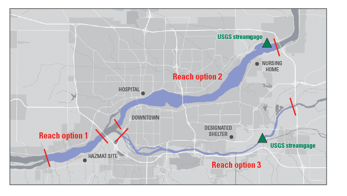
Figure 2. Communities often have multiple stream reaches that can be considered for flood modeling. Areas where flooding could affect critical infrastructure (such as bridges, utilities, or hazardous materials) or important human resources (such as hospitals, shelters, and densely populated areas) should be prioritized. Reaches where an existing USGS streamgage is located are also ideal. In this fictional example, Reach option 2 is the likely the best candidate for flood inundation mapping.
Sources/Usage
Public Domain.