
Fire, annual grasses, and nest site selection and survival for grouse
Detailed Description
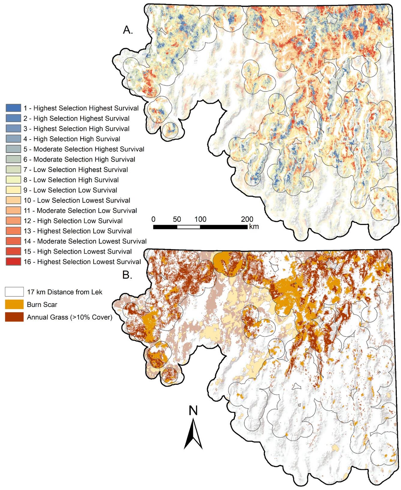
(a) Maps model‐projected nest site selection integrated with nesting productivity (i.e., nest survival), demonstrating the spatial distribution of adaptive versus maladaptive habitat selection at each 30 m pixel. Areas of greatest sage‐grouse occupancy are highlighted within 17 km of all active leks in the study area.
(b) Map of burned areas from a cumulative burned area model representing burn scars and annual grass cover >10% in the same study region. Burned areas were represented based on wildfires occurring between 1984 and 2017 that had not recovered to 20% sagebrush cover, or had otherwise experienced a permanent state transition to annual grass based on simulated sagebrush regrowth across varying soil temperature and moisture regimes
Sources/Usage
Public Domain.