
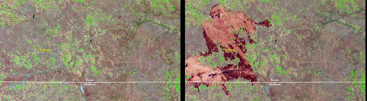
Fires Burn Farms and Ranches in Oklahoma and Kansas

Detailed Description
Landsat's shortwave infrared (SWIR) band measures reduced moisture content in soil and vegetation. When combined with its near-infrared (NIR) band, which helps reveal actively growing vegetation, Landsat produces highly accurate images and maps of burned areas.