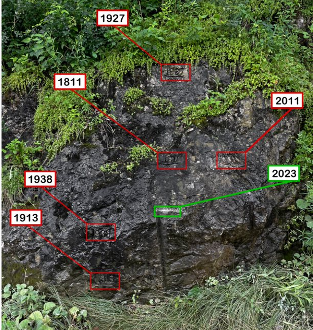
'Flood Rock' in Pittsford, Vermont, Near Otter Creek

Detailed Description
This is the "Douglas Flood Rock,” which has been used to document floods near Otter Creek in Pittsford, Vermont, since 1811. Local engravers in the area mark the flood rock at the highest water level after every big flood event. Locally called “Flood Rock,” this marble ledge is listed in the Pittsford Second Sentry Historical Book.
Sources/Usage
Public Domain.

