
Flooding of the Souris River
Detailed Description
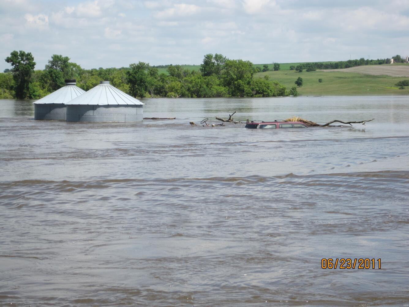
The Souris River flooding near Sherwood, North Dakota.On June 23, 2011, USGS personnel were there to measure the streamflow. Streamflow was approximately 27,100 cubic feet per second, stage approximately 27.98 feet.
Sources/Usage
Public Domain.