
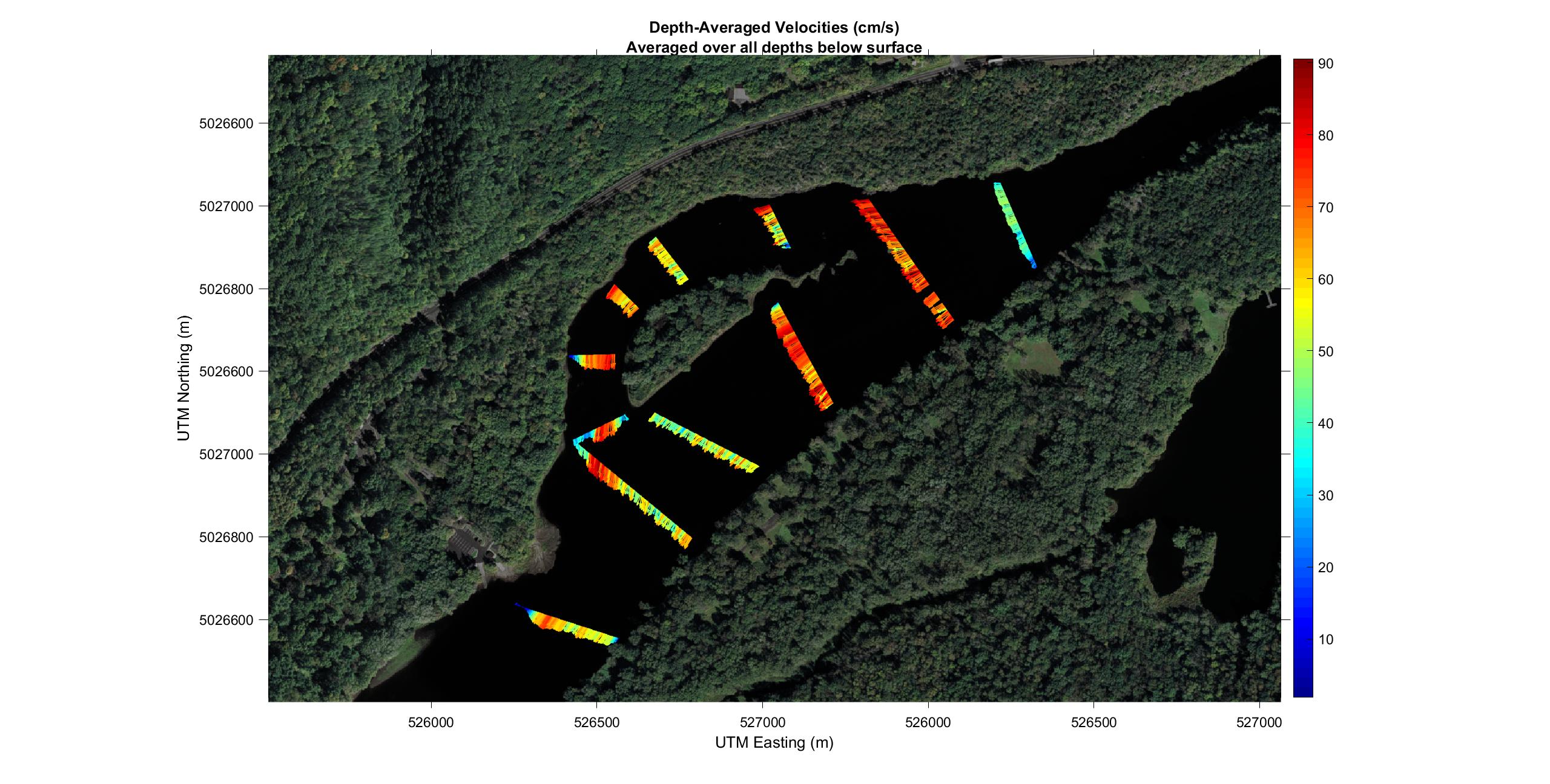
Folsom Island, river velocities.

Detailed Description
Depth-Averaged Velocities of the St. Croix River by Folsom Island at normal water level. The river velocities were measured using an acoustic Doppler current profiler, and visualized using the Velocity Mapping Toolbox (Engel, F.L. and Jackson, P.R. 2017. The Velocity Mapping Toolbox: User guide for version 4.09. U.S. Geological Survey).
Sources/Usage
Public Domain.