
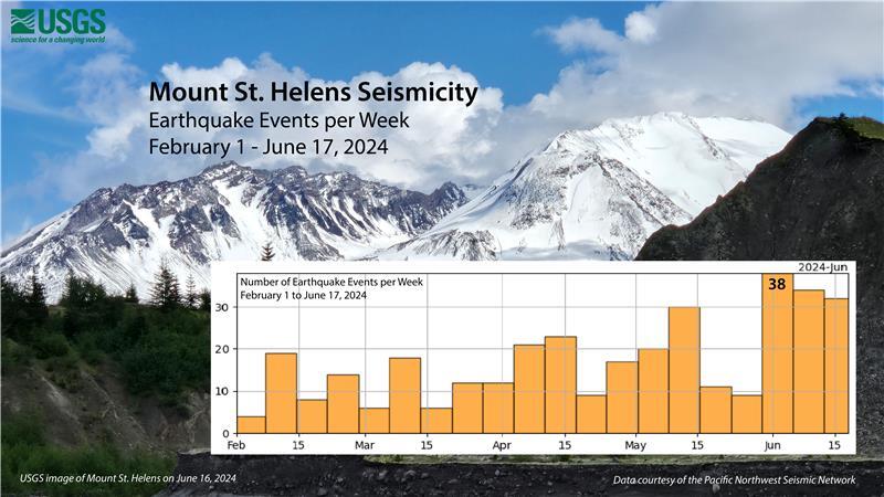
Graphic depicting 350 earthquakes that were located at Mount St. Helens between February 1 to June 17, 2024
Detailed Description
From February 1 to June 17, 2024, approximately 350 earthquakes were located at Mount St. Helens by the Pacific Northwest Seismic Network. Over 95% of the earthquakes were less than a magnitude 1.0 and too small to be felt at the surface. The number of earthquakes located per week appears to have reached a peak in early June, at 38 events per week. USGS graphic. Data courtesy of the Pacific Northwest Seismic Network. Background image of Mount St. Helens from the North Fork Toutle River taken June 16, 2024, by L. Westby.
Sources/Usage
Public Domain.