
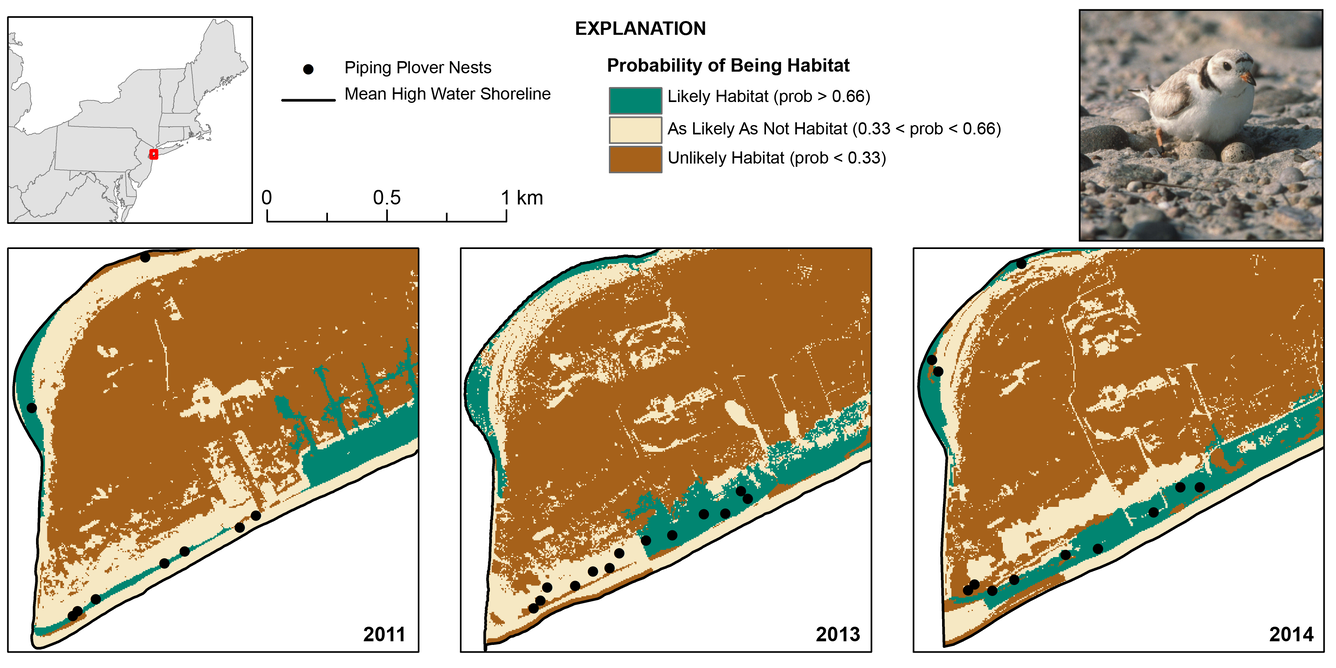
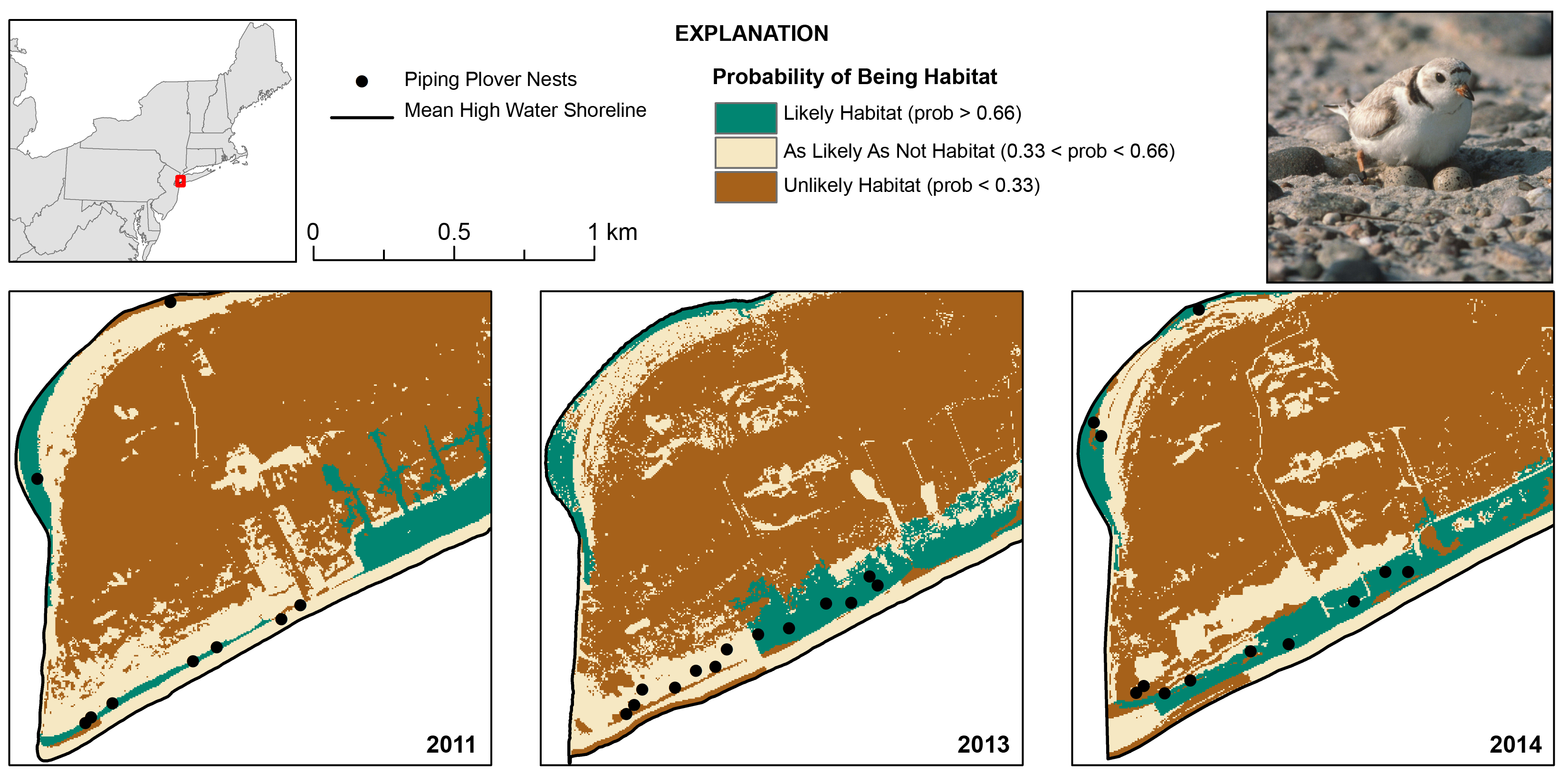
Habitat suitability map and change between 2011 and 2014
By St. Petersburg Coastal and Marine Science Center
January 2021 (approx.)
Detailed Description
Habitat suitability map and change between 2011 and 2014, as derived from a model of nesting piping plover habitat selection. This map shows areas of high suitability (green) on the Rockaway Peninsula, New York. Models like this and their associated habitat maps are also being developed for nesting sea turtles and wintering shorebirds. (Piping plover photo by Bill Byrne, U.S. Fish and Wildlife Service).
Sources/Usage
Piping plover photo by Bill Byrne, U.S. Fish and Wildlife Service