
How Do You Landsat Research with Jacques Cousteau

Detailed Description
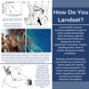
A joint NASA-Jacques Cousteau expedition sought to verify Landsat bathymetry data. Scientists used the Bahamas and Florida as a testing site for their experiment. Two ships, Calypso and Beayondan, were at anchor during the Landsat overpasses.
Satellite remote bathymetry was verified up to twenty two meters deep with specific water clarity parameters. The results were used to update charts, hazardous shoals and monitoring changes in nearshore topography.
Read the Research Here: https://ntrs.nasa.gov/citations/19780007719
Sources/Usage
Public Domain.