
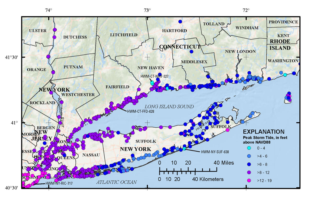
Hurricane Sandy Storm Tide Elevation in Connecticut
By New England Water Science Center
October 2012 (approx.)
Detailed Description
A map indicating peak storm tide in feet above NAVD88 during Hurricane Sandy, October 2012.
Sources/Usage
Public Domain.