
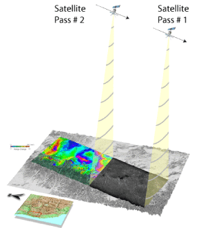
Illustration of the methodology for collection of an InSAR image.

Detailed Description
A satellite passes over an area and records data about it. Two or more passes are needed to create the InSAR images we use to examine changes in ground height.