
Instrumented platform into San Francisco Bay
By Pacific Coastal and Marine Science Center
February 2011 (approx.)

Detailed Description
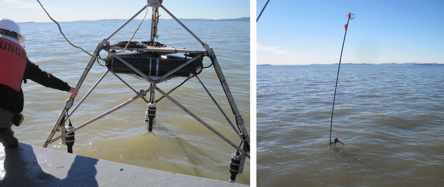
At left, USGS Marine Technician Jenny White steadies an instrumented platform as it is winched into the water at the Middle station (see map of study area), where the depth of the bay floor is 0.5 m below MLLW. Photograph taken February 2, 2011, by Lissa MacVean. At right, the platform, deployed at high tide, is now resting on the bay floor, and all that's visible is a warning flag to alert boaters. During low tide, all but 0.5 m of the platform (which is a little more than 2-m tall) will be exposed to the air.
Sources/Usage
Public Domain.