
Kīlauea LERZ Fissures and Flows, May 16 at 7:00 a.m

Detailed Description
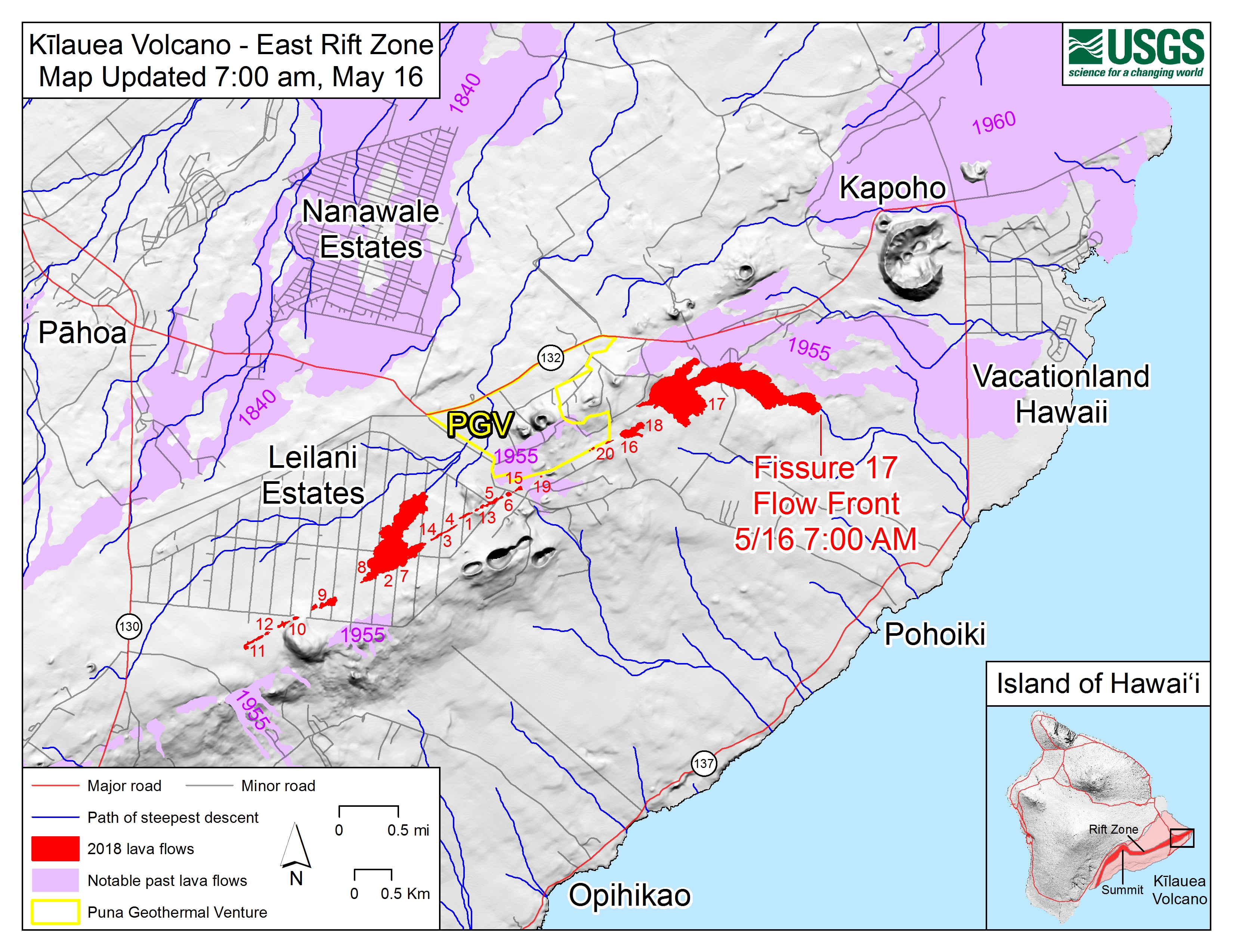
Map shows the location of the lava flow spreading from fissure 17 as of 7:00 a.m. HST, May 16. The flow is following a path of steepest descent (blue line) south of a 1955 'a'ā flow. Shaded purple areas indicate lava flows erupted in 1840, 1955, 1960, and 2014-2015.
Sources/Usage
Public Domain.