
Kīlauea summit thermal map - Dec 21, 2020) at approximately ~11:30 AM
By Kīlauea

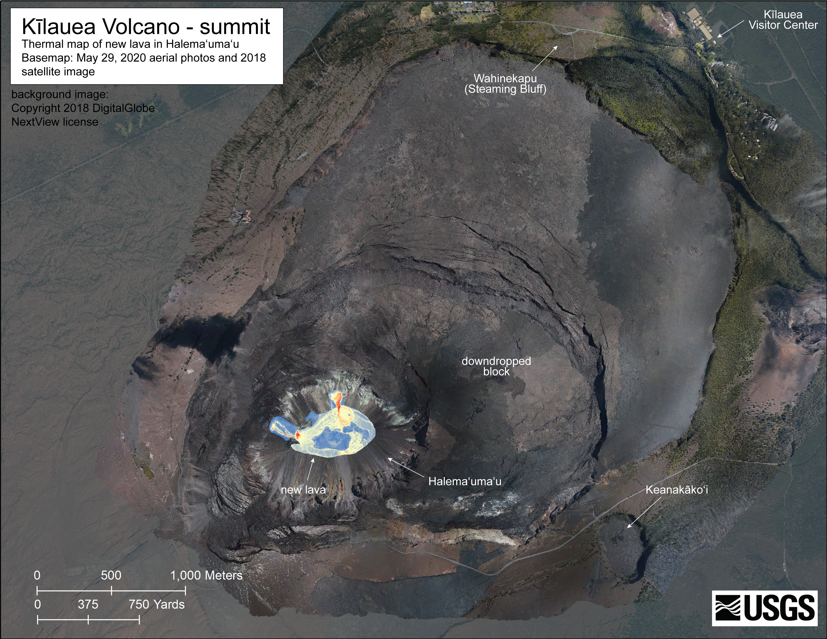
Detailed Description
A helicopter overflight today (Dec 21, 2020) at approximately ~11:30 AM HST allowed for aerial visual and thermal imagery to be collected of the new eruption within Halema'uma'ucrater at the summit of Kīlauea Volcano. This preliminary thermal map shows that the new lava lake is 580 m (yd) E-W axis and 320 m (yd) in N-S axis. The lake area is about 13.6 hectares (33 acres). USGS map by M. Patrick.
Sources/Usage
Public Domain.