
Lake Ozette bathymetry
By Pacific Coastal and Marine Science Center
2019 (approx.)

Detailed Description
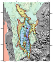
Bathymetric map of Lake Ozette, showing locations of core samples (red circles).
Sources/Usage
Public Domain.