
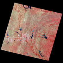
Landsat 1 First Light Image of Texas

Detailed Description
Dallas-Fort Worth, Texas, slid into Landsat 1's view on July 25, 1972. In this false-color image, shades of red indicate vegetated land and grays and whites are urban or rocky surfaces. The composite image is shown using the near-infrared, red and green bands (bands 7, 5, 4) at a 60 meter resolution.
Learn more on the Landsat 1 mission webpage
Sources/Usage
Public Domain.