
Landsat 5 imagery Assateague Island
By St. Petersburg Coastal and Marine Science Center
2015 (approx.)
Detailed Description
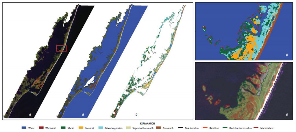
Landsat 5 imagery classification based on (A) radiometrically corrected image, (B) unsupervised classification to identify water areas, and (C) seven classes (water, wet marsh, marsh, forested, mixed vegetation, vegetated bare earth, and bare earth). The enlargement shows (D) sample classifications and (E) line features.