
Landsat Level-2 SR and Level-3 Burned Area Science Product Side by Sid

Detailed Description
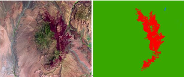
Side-by-side images over West Mountain Peak, West of St. George, UT of Landsat Surface Reflectance (SR) Analysis Ready Data (ARD) tile (Left Image) and Landsat Level-3 Burned Area (BA) Science Product tile-based image (Right Image) derived from Landsat 5 ARD Tile Horizontal 006, Vertical 010, July 7, 2003.