
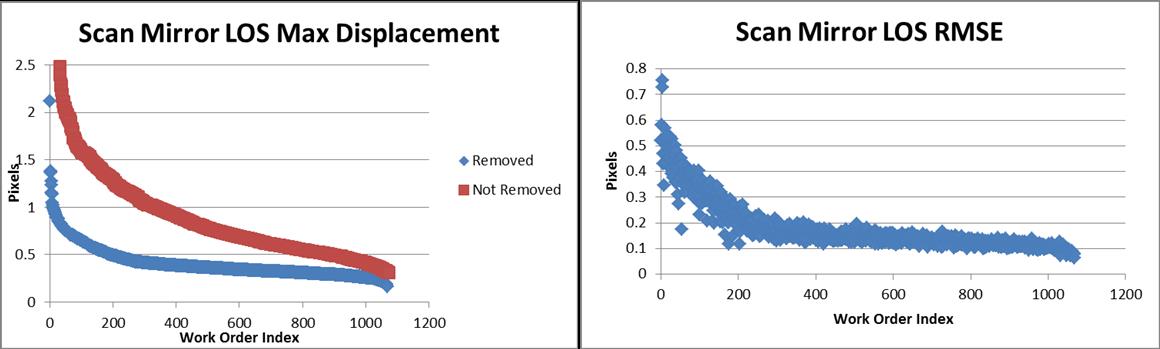
Landsat No-Payload Correction Data Calculated Angular Displacement

Detailed Description
Calculated Angular Displacement associated with the Payload Correction Data (PCD) of a given set of Landsat TM datasets. Left: Maximum error calculated (Y axis) and the results with the linear trend (removed and not removed). Right: Accumulated error across the full image (Y axis) with the linear trend removed from the integrated attitude.
Sources/Usage
Public Domain.