
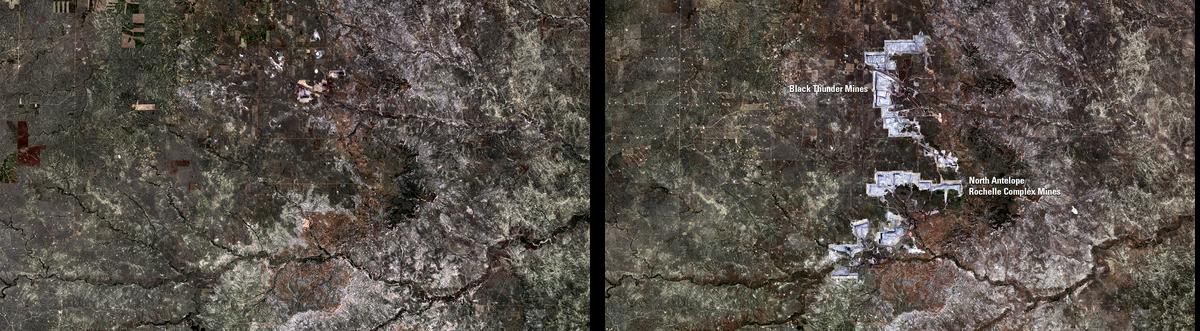
Landsat Reveals Industrial Growth in Powder River Basin

Detailed Description
The expanding coal fields in Wyoming's Powder River Basin serve as prime examples of Landsat's ability to monitor land cover change related to industrial growth across the American landscape.
Sources/Usage
Public Domain.