
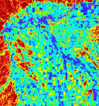
Landsat Thematic Mapper image 2

Detailed Description
Landsat Thematic Mapper image was taken June 2006 of portions of the Uncompahgre and Lower Gunnison Valleys in the Upper Colorado River Basin. The image on the left is a composite color image while the right shows 24-hour evapotranspiration developed using an energy balance model (red: low to purple: high evapotranspiration rates). Courtesy of the U.S. Bureau of Reclamation.