
Lidar data shows change in beach profile
By Pacific Coastal and Marine Science Center
2012 (approx.)

Detailed Description
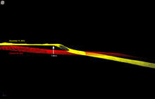
Lidar data collected in 2010 and 2012 showing a change in the beach profile. Spot marked by vertical arrow was about 1 meter (3 feet) higher after two years.
Sources/Usage
Public Domain.