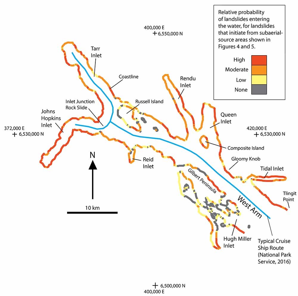
Map of Glacier Bay Showing the Relative Probability of Landslides

Detailed Description
Map of Glacier Bay showing the relative probability of landslides entering the water along the coastline of the West Arm.
Sources/Usage
Public Domain.

Official websites use .gov
A .gov website belongs to an official government organization in the United States.
Secure .gov websites use HTTPS
A lock () or https:// means you’ve safely connected to the .gov website. Share sensitive information only on official, secure websites.
Map of Glacier Bay showing the relative probability of landslides entering the water along the coastline of the West Arm.
Public Domain.