
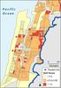
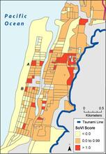
Map of Seaside, Oregon, that shows statistical results

Detailed Description
Map of Seaside, Oregon, that shows statistical results of a social vulnerability index, which identifies relative areas of heightened demographic sensitivity to a tsunami (blue line) associated with a Cascadia subduction zone earthquake
Sources/Usage
Public Domain.