
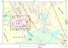
Map showing regional tectonic setting
By California Volcano Observatory
2010 (approx.)

Detailed Description
Map showing regional tectonic setting of area from Sacramento Valley to California-Nevada border.
Sources/Usage
Public Domain.