
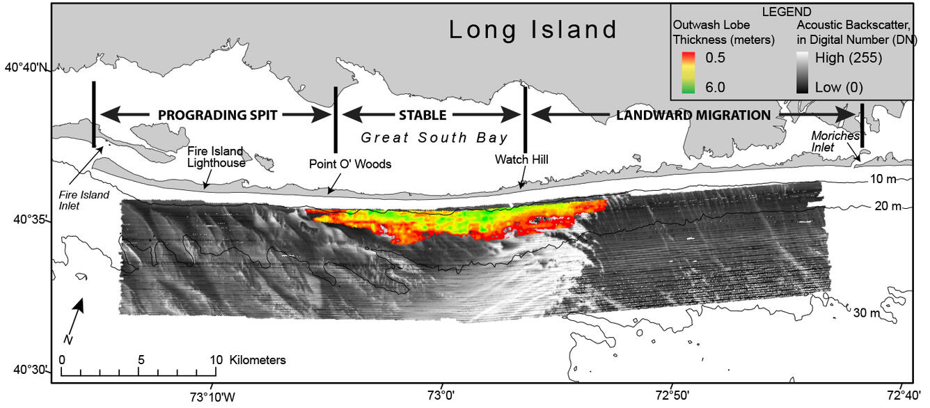
Map showing the thickness of a relatively young Pleistocene outwash
By Woods Hole Coastal and Marine Science Center
2011 (approx.)
Detailed Description
Map showing the thickness of a relatively young Pleistocene outwash lobe in meters mapped using chirp seismic-reflection profiles collected in 2011, overlain on acoustic backscatter imagery. Regional bathymetric contours are in meters.
Sources/Usage
Public Domain.