
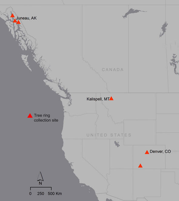
Map of tree-ring data sites from three distinct climate zones
Detailed Description
Tree-ring data sites from three distinct climate zones, Maritime (southeast Alaska) Intermountain (northern Rockies) and Continental (central/southern Rockies), allow USGS scientists and their collaborators to understand how regional climate patterns influence avalanches.
Sources/Usage
Public Domain.