
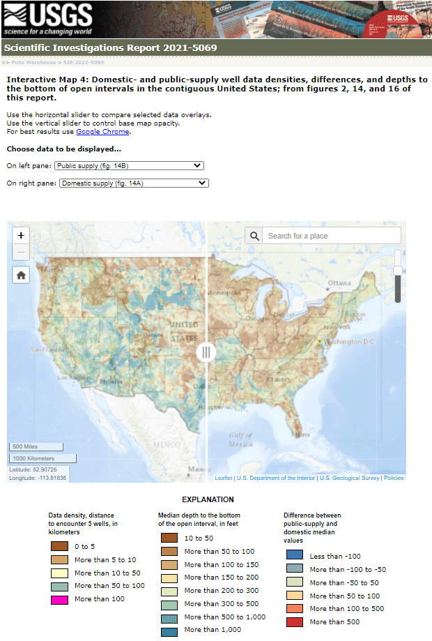
Map of a typical depth to the bottom of wells in the conterminous United States

Detailed Description
A static image of interactive map with the typical depth to the bottom of the open intervals of public-supply wells to the left and domestic-supply wells to the right of the movable slider.
Sources/Usage
Public Domain.