
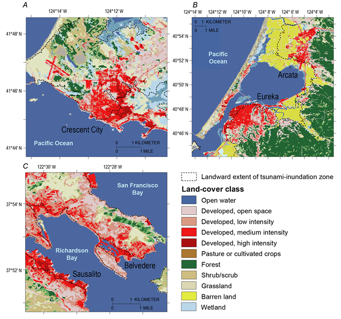
Maps of the California maximum tsunami-inundation zone

Detailed Description
Maps of the California maximum tsunami-inundation zone and land-cover data from the 2006 National Land Cover Database for (A) Crescent City, (B) Eureka, and (C) Belvedere
Sources/Usage
Public Domain.