
Maps of Ocean Shores showing modeled pedestrian travel times to safety

Detailed Description
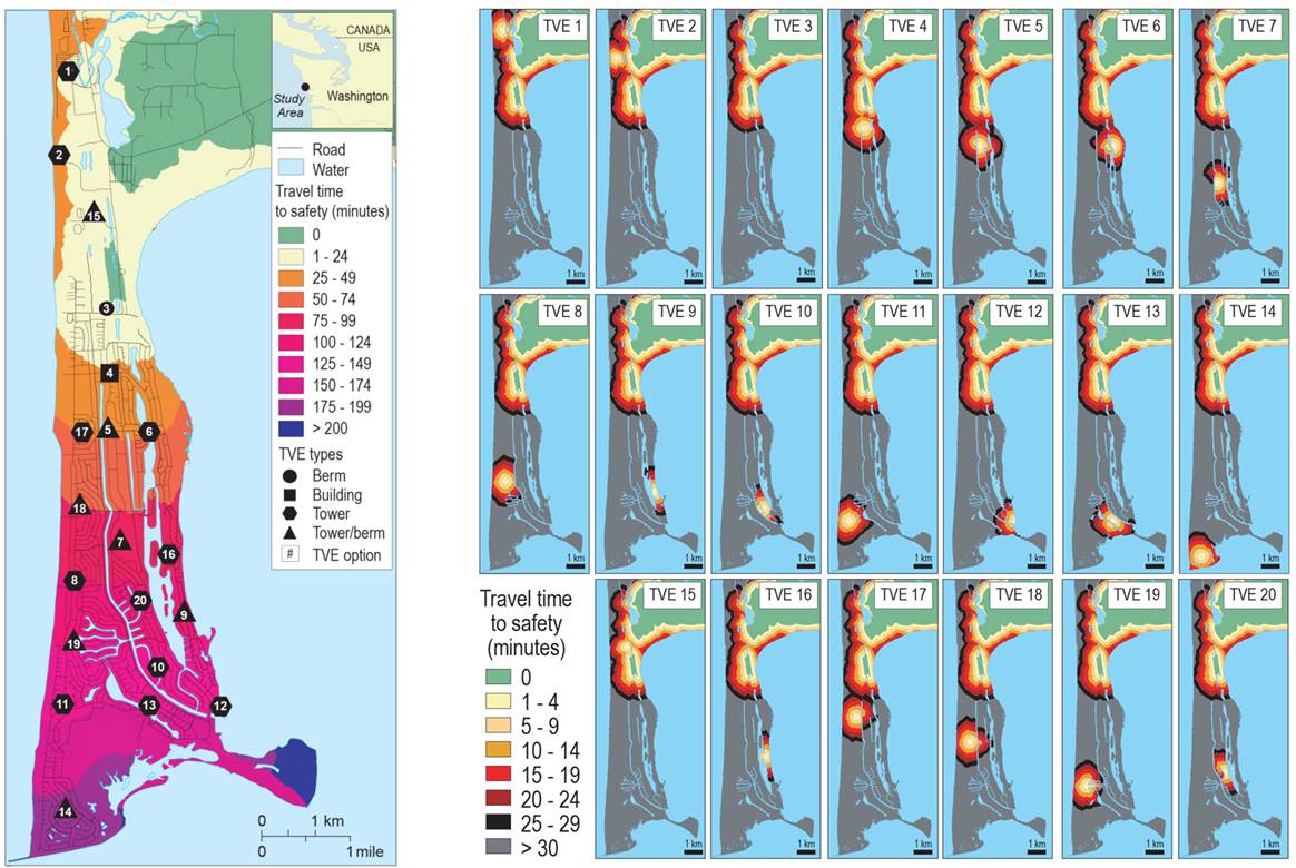
Maps of Ocean Shores showing modeled pedestrian travel times to safety (assuming a slow walking speed) for a tsunami zone associated with a Cascadia subduction zone earthquake. The first map also show potential vertical evacuation sites identified by community members. The second series of maps show modeled travel times to safety based on the construction of each refuge. Waves are estimated to arrive approximately 25 minutes after generation.
Sources/Usage
Public Domain.