
Maps of Yellowstone Lake earthquake swarm (2008-2009) with a model ...
By Volcano Hazards Program
2010 (approx.)
Detailed Description
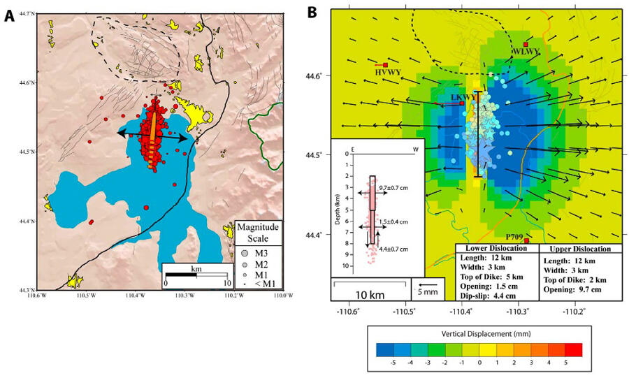
A. Location of earthquakes at the north end of Yellowstone Lake, with the direction of spreading of the deep fracture modeled as a vertical volcanic dike showing seismic and ground displacement data. B. Model of expansion of a single dike into three segments with different rates (upper and lower) used to explain the modeled displacement and related seismic activity.
Sources/Usage
Public Domain.
Farrell et al, 2010