
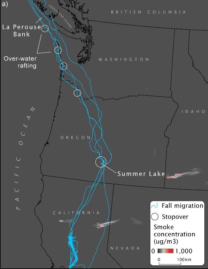
Maximum smoke extent and migratory paths of tule geese, 2019

Detailed Description
Fall migration routes for five tule geese in 2019 through arrival at Summer Lake Wildlife Area, Oregon, and maximum extent of wildfire smoke during that time.
From:
Overton, C.T., Lorenz, A.A., James, E.P., Ahmadov, R., Eadie, J.A., McDuie, F., Petrie, M.J., Nicolai, C.A., Weaver, M.L., Skalos, D.A., Skalos, S.M., Mott, A.L., Mackell, D.A., Kennedy, A., Matchett, E.L., Casazza, M.L. 2021. Megafires and thick smoke portend big problems for migratory birds. Ecology. https://doi.org/10.1002/ecy.3552
Basemap source: Esri, HERE, Garman, Open StreetMap contributors, and the GIS user community
Sources/Usage
Public Domain.