
Methane measurements
Detailed Description
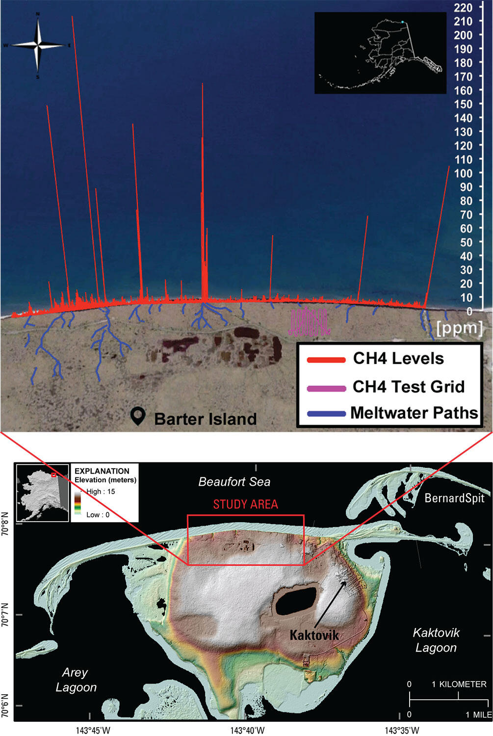
Top: Methane measurements (red) reveal hotspots (peaks) aligned with major melt-water pathways (blue lines) in coastal permafrost bluffs on Barter Island, Alaska. Pink grid is where researchers conducted test flights above intact permafrost with relatively constant methane levels. Bottom: Map of Barter Island showing location of study area.
Sources/Usage
Public Domain.