
Tutorial_Image_Tile.png
By Land Change Monitoring, Assessment, and Projection
December 2021 (approx.)

Detailed Description
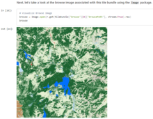
A screenshot from the "Accessing LCMAP Data via the USGS EarthExplorer Machine-to-Machine API" tutorial, demonstrating how to browse images within a tile bundle.
Sources/Usage
Public Domain.