
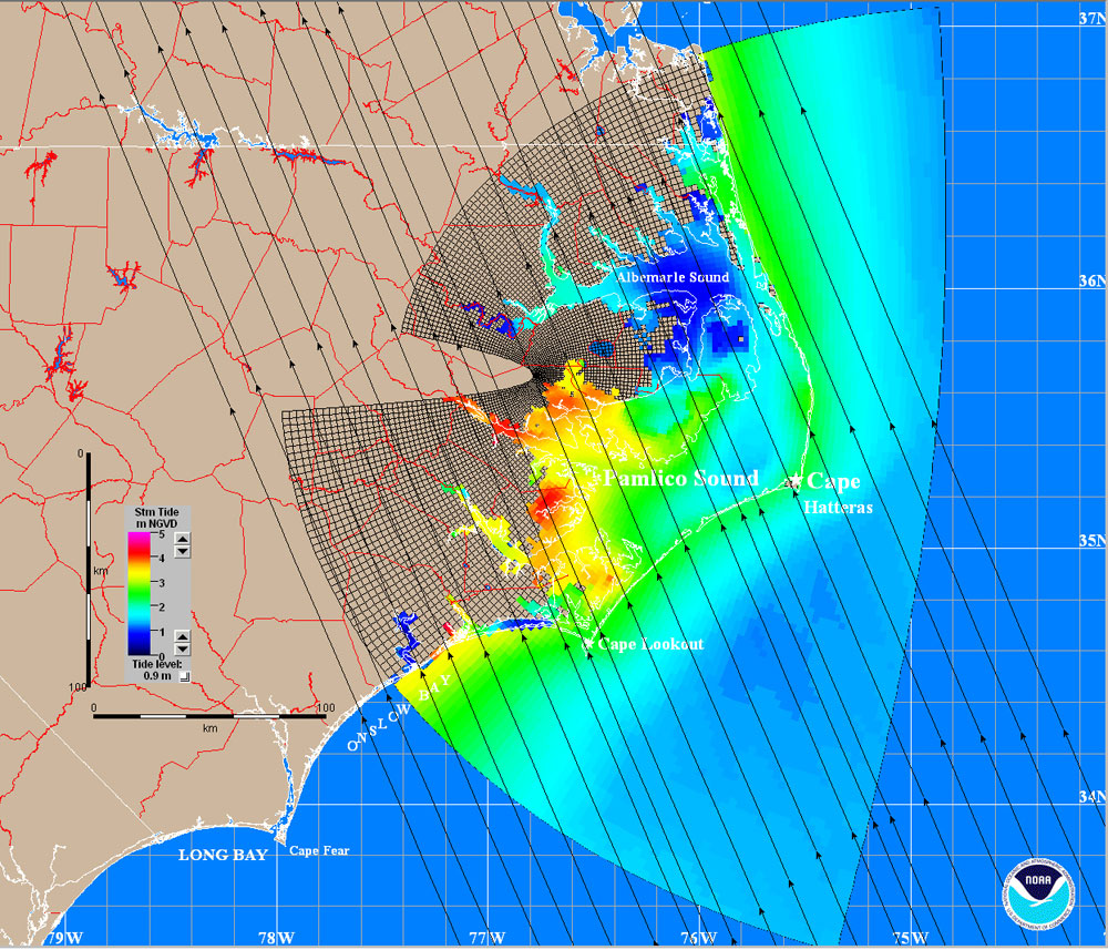
Modeled, maximum surge elevations, as simulated by the NOAA SLOSH mode

Detailed Description
Modeled, maximum surge elevations, as simulated by the NOAA SLOSH model, for a category 3 hurricane making landfall in the Pamlico Sound basin of North Carolina at a forward speed of 15 m/s. The values shown, representing the 'maximum envelope of water,' are obtained by running several similar hypothetical storms onshore along parallel tracks (shown by black arrows).
Sources/Usage
Public Domain.