
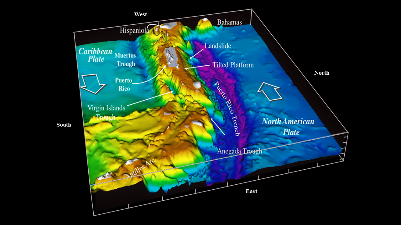
Morphology and color-shaded bathymetry of the Puerto Rico Trench
By Natural Hazards Mission Area
2000 (approx.)

Detailed Description
Morphology and color-shaded bathymetry of the northeastern Caribbean region. Digital data courtesy of Troy Holcombe and Lisa Taylor, National Geophysical Data Center, Boulder, Colorado. From the International Bathymetric Chart of the Caribbean Sea and the Gulf of Mexico, sheet 1–09, published by Instituto Nacional de Estadística, Geografía e Informática, Mexico, 1992.
Sources/Usage
Public Domain.