
Mount Jefferson, OR simplified hazards map
By Volcano Hazards Program
2017 (approx.)

Detailed Description
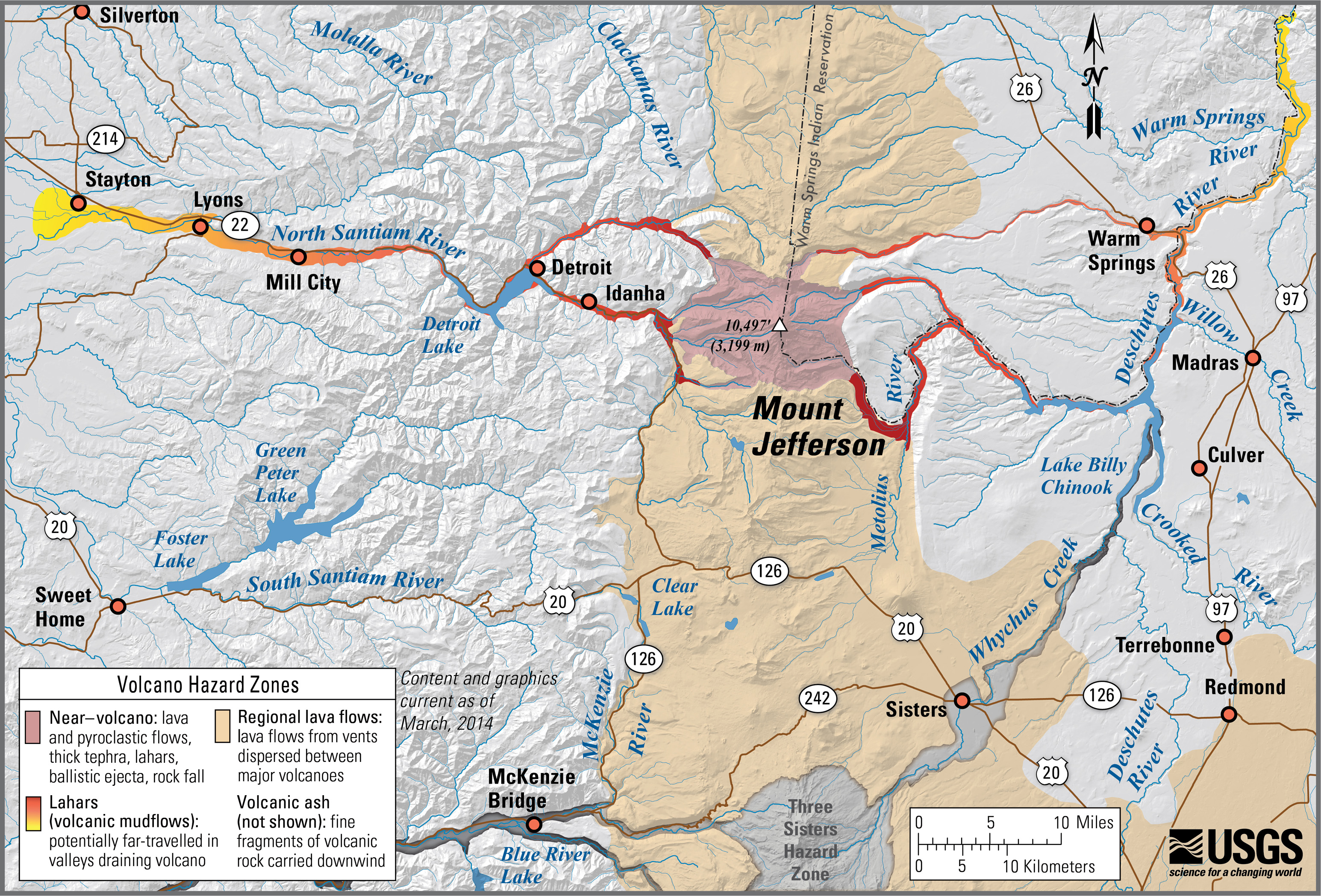
Mount Jefferson, Oregon simplified hazards map showing potential impact area for ground-based hazards during a volcanic event.