
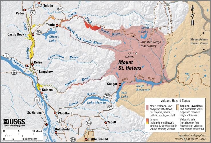
Mount St. Helens Simplified Volcano Hazards Map

Detailed Description
Mount St. Helens, Washington simplified hazards map showing potential impact area for ground-based hazards during a volcanic event. More simplified volcano hazard maps for the other Cascades Volcanoes can be found here.
Sources/Usage
Public Domain.