
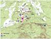
Norris-2003. Location map of seismometers and GPS receivers deploye...
By Volcano Hazards Program
2003 (approx.)

Detailed Description
Norris-2003. Location map of seismometers and GPS receivers deployed to help monitor the Norris Geyser Basin.
Sources/Usage
Public Domain.