
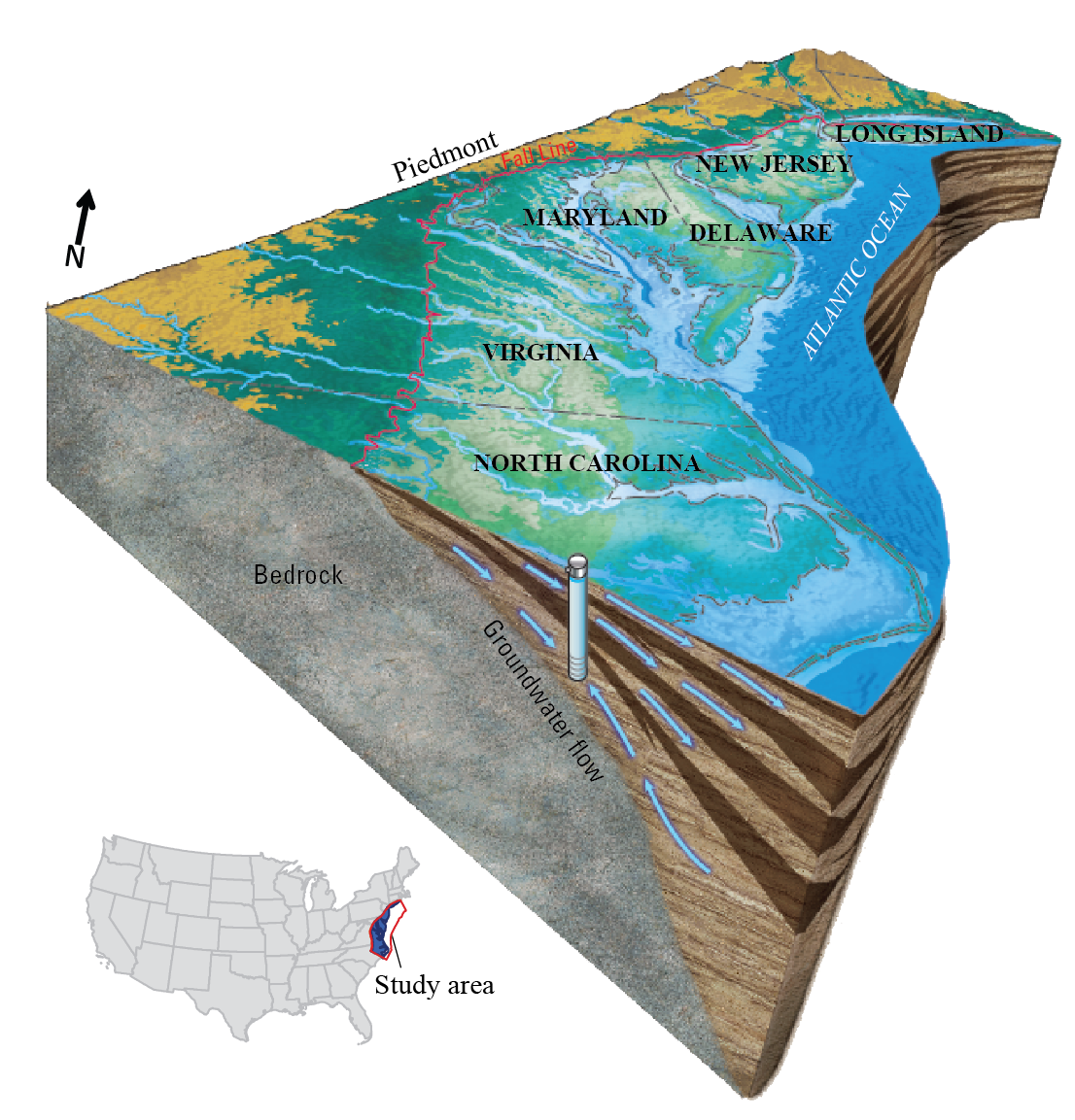
Northern Atlantic Coastal Plain aquifer system

Detailed Description
Block diagram showing the Northern Atlantic Coastal Plain aquifer system, which includes the areas east of the Fall Line from Long Island to northern North Carolina. This multilayer system consists of confined aquifers and confining units capped by an unconfined, surficial aquifer. Groundwater flows predominantly from west to east from the Fall Line to the Atlantic Ocean, except where high-capacity pumping wells alter this regional flow pattern.